The Blue Ridge Parkway extends 469 miles through the southern Appalachians and it is no ordinary road. No commercial vehicles are allowed and no commercial developments are along the road. It is all nature and all beautiful.
Today we covered just over 50 miles from Asheville and back. It was one beautiful vista or forest glen after another. We traveled north only as far as Crabtree Falls and then back and it took us from 9:00 a.m. to 4:30. I tell you about that 3-mile hike later in the blog.
The speed limit on the road is 45 mph, but I think we probably averaged about 30 because we pretty much had the highway to ourselves and we were not trying to get from point A to point B in the shortest time possible.
The road we drove is cut alongside of the mountains and in a few cases through the mountains. Miles and miles of the highway were lined with blooming rhododendron bushes -- although what we saw was mostly the end of the blooming cycle. The green of the tree leaves is that lush and vibrant spring green. The temperature dropped as low as 66 up in the mountains and the highest elevation we reached was 6684 feet. It has rained a fair amount recently so we were treated to rock wall faces glazed with run off water so the granite was a shiny black.
We hiked a short but steep trail up to the top of Mt. Mitchell. The mountain is named after Elisha Mitchell, a professor at the University of North Carolina, who determined its height in 1835, and fell to his death at nearby Mitchell Falls in 1857, having returned to verify his earlier measurements. Rev. Mitchell is buried on top of the 6684 foot high mountian where we would like to belive his spirit is pleased with the view and his recognition.
This is the top of Mt. Mitchell, where the Rev. Mitchell is buried. An ironic note to his death is that one of his students challenged Rev. Mitchell's determination of the mountain's height. So Rev. Mitchell returned to the mountain to verify his measurement and it was on that trip that he fell to his death.
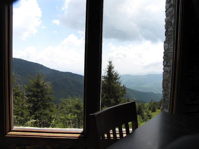
Mt. Mitchell is located in the Pisgah National Forest. We had lunch at the restaurant near the top of the mountain where this was the view from our table.
A row of inviting rockers line the terrace at the restaurant.
After lunch we drove to Crabtree Falls for a moderately strenuous 3 mile round trip hike back into the mountain to see a beautiful water fall.
At least half of the hike was on a trail like this. But was worth the effort because we got to see this:
Tomorrow we will drive in the opposite direction to see what we can find.


I could rock several hours away on that terrace! Gorgeous shots!
ReplyDelete